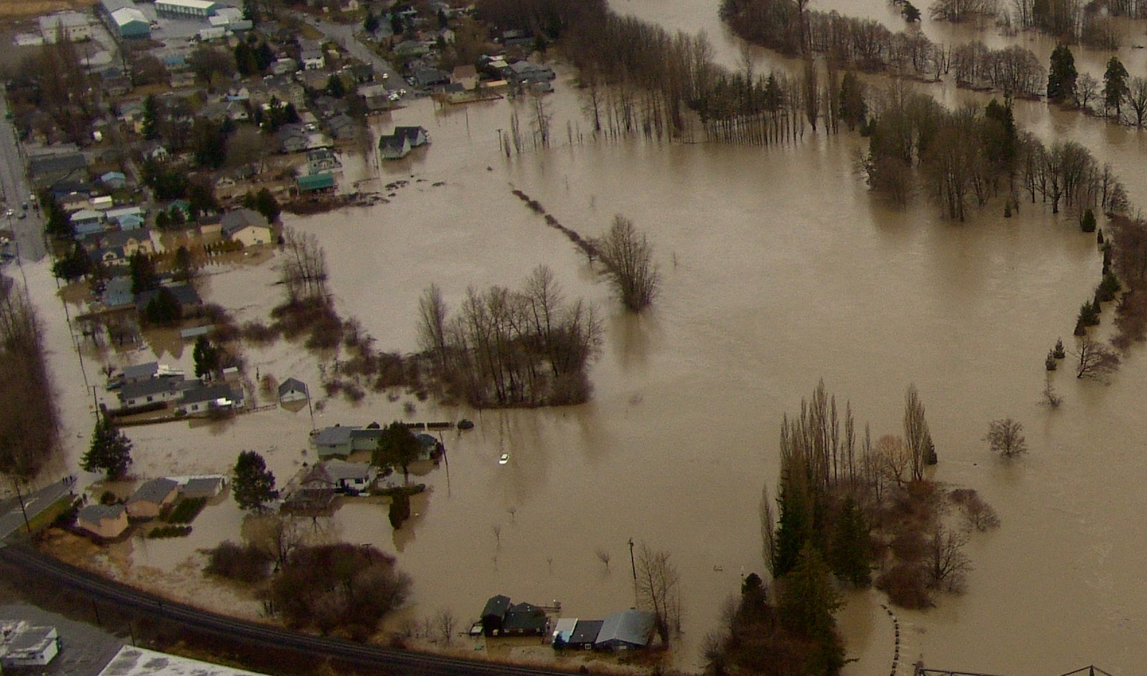
FERNDALE, Wash. — Forecasters warn of the potential for a significant river flooding event occurring at Ferndale beginning late Friday, continuing through the weekend and into next week.
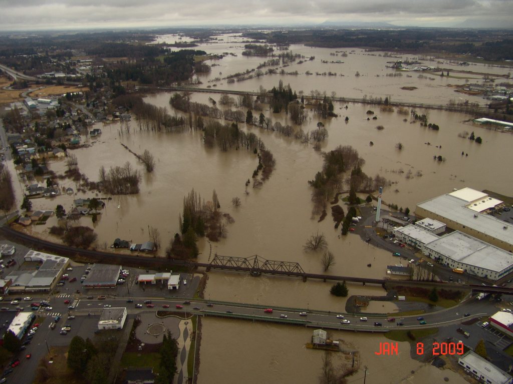
This scenario is similar to the one that occurred when the Nooksack River crested January 8, 2009 at 22.76 feet in Ferndale. The river, which typically recedes after cresting, remained above 20 feet over 5 days according to City of Ferndale Public Works Supervisor Bo Westford. The resulting river flooding caused residential and commercial property damage as well as road impacts that included water encroaching onto I-5 at places.
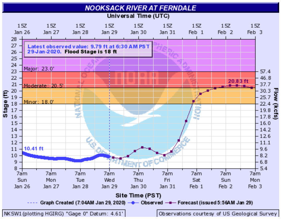
If the river achieves the current forecast crest level of 20.83 feet, it would be the highest the river has risen at Ferndale since the 22.76-foot crest in 2009 which was preceded by a 23.56-foot crest that occurred in 1990.

The 2009 flood event was the result of warming that melted the mountain snow pack and heavy mountain rain. This weekend’s flooding event will be the result of “a period of warming, rising snow levels and heavy rain in the mountains” according to National Weather Service (NWS) forecasters.

Click for more information
NWS Seattle office issued the following hydrologic outlook statement yesterday:
Heavy rain overnight and another round of rain Wednesday night will keep rivers at elevated levels and the ground very wet. A heavy rain event is forecast for Friday through Saturday. One to three inches are expected in the lowlands with four to seven inches in the mountains. Snow levels will be rising above 6000 feet. This amount of rain could produce flooding on many rivers, streams, and urban areas. At this time, there is some possibility of moderate or even higher flooding. The landslide threat will also be increasing.
While the expected crest level is far from the record 31-foot historic crest of 1951, property owners near the river should continue to monitor the latest Nooksack River level forecast as it can change frequently and be prepared for potential hazards and property damage resulting from river water spilling outside the banks of the river and onto property.
Road closures are likely and drivers need to be alert for water and debris over low-lying roads near the river and streams and obey road closed signs.
Discover more from Whatcom News
Subscribe to get the latest posts sent to your email.
Gees guess climate warming began in 1951????
Al Saab. Gees guess climate change began in 1951????
It began a long time before that…when coal had become the major energy source for the industrial revolution in the 1800s.
Climate change started around 4.5 billion years ago – give or take. Anyone that truly believes that our earth’s climate should remain absolutely constant at all times needs to do some real research and listen to some folks who DON’T have a vested financial interest in promoting the notion of “climate change”. Or, you can choose to believe that Florida will be underwater in 12 years – your call.
The problem isn’t exactly that the climate is changing… it’s that it is changing unprecedentedly fast – many many orders of magnitude fast — and does not give creatures time to adapt.