WHATCOM COUNTY, Wash. — The short-term weather forecast for areas within Whatcom County call for mild temperatures along with mostly light winds and rain. This forecast is expected to hold through Tuesday, December 3rd. when a much different forecast is currently being made.
The next organized frontal system may begin to approach the coastline by around midweek to bring a return of more widespread precipitation chances.
– National Weather Service (November 27, 2024)
Rain is forecast for Monday and Tuesday and moderate rain is expected to arrive to the Washington coast and Puget Sound area about midweek. Easterly winds and a return to high temperatures in the 50s are expected to accompany this weather system.

Click for more information

Click for more information
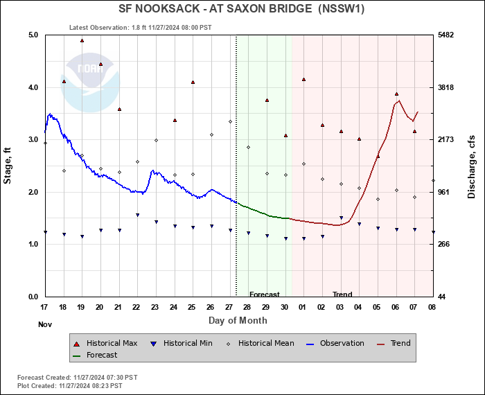
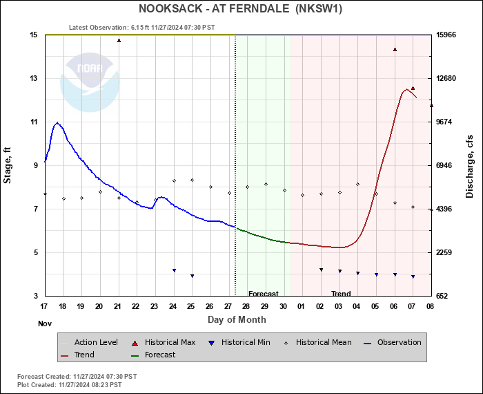
Current Nooksack River level forecasts reflect corresponding increases with crests occurring December 6th about 2-feet below action levels.

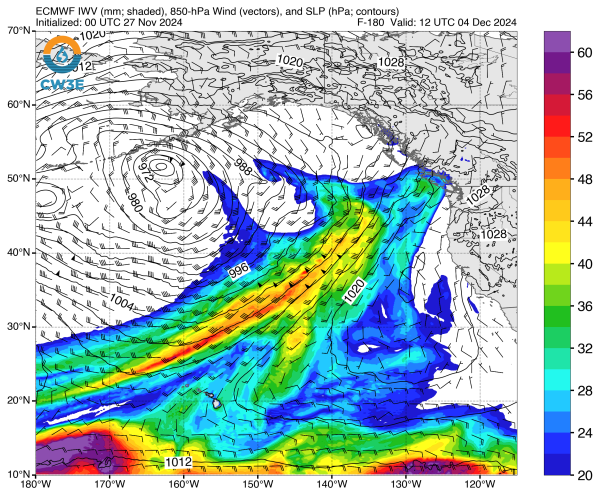
Heavy rains are possible immediately following the first system as indicated on the forecast graphic below (more water content appears as yellow and red).
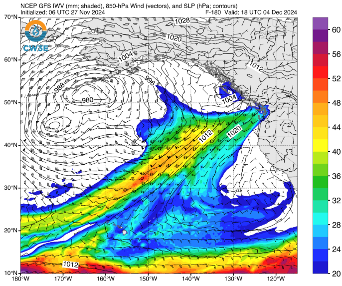
The impact of these weather systems will depend on where they make landfall. At least 1 computer model forecast has it arriving further to the north.
These are long-term weather forecasts and subject to change over time.
Whatcom News readers are encouraged to stay up to date with current weather alerts and forecasts and air quality readings for their specific Whatcom County locations along with tide tables via the Whatcom News Weather page.
Discover more from Whatcom News
Subscribe to get the latest posts sent to your email.