WHATCOM COUNTY, Wash. — Current snow forecast models appear to respect impacts possible from the Fraser Valley outflow during what is expected to be a snow event today, December 25th.
The northeasterly outflow winds are expected to increase dramatically according to a wind advisory issued by the National Weather Service this morning. The advisory says to expect sustained northeast winds of 20 to 35mph with gusts up to 50mph through Monday morning.
There is also a current winter storm warning in effect through late tomorrow afternoon due to heavy snow expected with total snow accumulations of 4 to 9 inches possible.
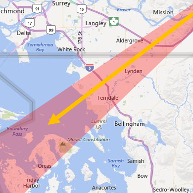
While a weather system carrying precipitation is expected to reach Whatcom County later today, the very cold and dry Arctic outflow air can be expected to either assist or hinder its snow potential in different locations across the county.

Click for more information

Click for more information
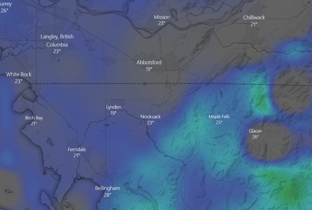
The NAM computer weather forecast model (above) shows expected snow accumulation over the next 24 hours with areas shown as dark blue and gray expected to get 1.5 inches or less and areas shown with lighter blue and green expected to get 3 to 5 inches.
Forecasters continue to expect the most snow accumulation this evening and into tomorrow morning.
This would not be the first occurrence of significant snow fall to the north and south but not in the outflow path. But there are also examples of more snow in the outflow path than outside.
The Whatcom News Traffic page provides a quick way to view real-time road conditions, including snow accumulations.
Discover more from Whatcom News
Subscribe to get the latest posts sent to your email.
