WHATCOM COUNTY, Wash. — The first 2 weather systems expected to reach Whatcom County in succession have passed, drenching areas further south in Puget Sound and in the mountains and with moderate winds. Another is expected to arrive tonight.
The next bout of moderate to heavy rains and wind is expected to arrive late tonight, Tuesday, December 9, 2025. Rains are expected to continue into late Wednesday, being heaviest around noon on Wednesday. Total rainfall of between 1 and 2 inches is possible on Wednesday.
South-southwest winds are expected to be blustery but unlikely to reach strengths high enough to warrant an advisory.
Rains are expected to be heavy in the lowlands as well as in the Cascades. With the already inundated soil, heavy rain poses greater risks of surface water pooling and stream flooding.

Click for more information

Click for more information
The current Nooksack River level forecast shows river levels cresting around the low end of the minor flood stage ranges.
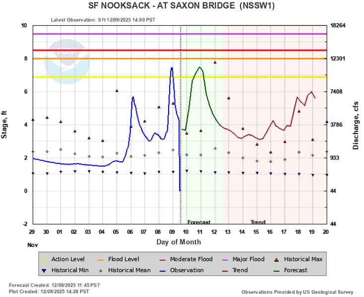
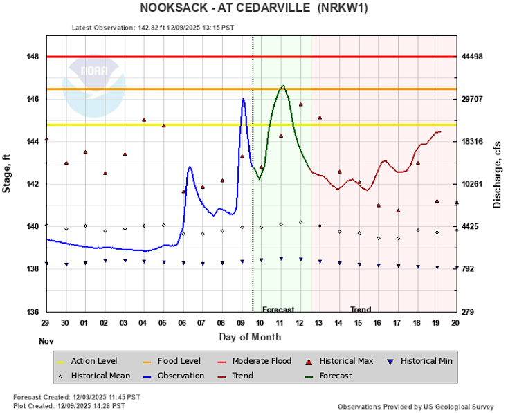
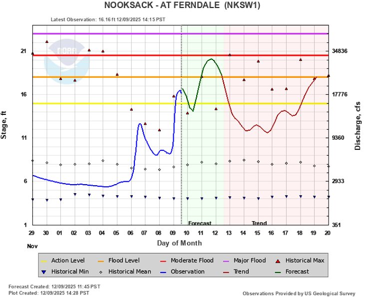
Road closures have already begun being reported at low lying points near the river.
River level forecasts can change frequently so motorists and property owners are advised to monitor the Nooksack River level forecast.
Whatcom News readers are encouraged to stay up to date with current weather alerts and forecasts and air quality readings for their specific Whatcom County locations along with tide tables via the Whatcom News Weather page.
Readers are encouraged to stay up to date on local driving conditions via the Whatcom News Traffic page.
Discover more from Whatcom News
Subscribe to get the latest posts sent to your email.