
Yesterday’s storm front brought with it significant winds and rain. But it would appear Ferndale incurred minimal disruption with only a few short-lived power outages even with scattered reports of downed trees. Now warnings are for the potential for flooding starting today, Friday, November 13th.
While there were over a dozen power outages at one point throughout Whatcom County, there was only one significant outage near Ferndale. That one occurred in Custer, impacted 800 Puget Sound Energy customers and power was restored in about an hour.
The strongest gust recorded yesterday at a weather station located near Ferndale High School was 61 MPH.

With this storm front came heavy local rains but not as heavy here as up in the Cascade Mountains where heavy snow and rain have been forecast. Reports are that up to 3 inches has already fallen with the potential for another 5 inches by Saturday. The snow level is also expected to rise later which will cause the new fallen snow to melt. All this rain and snow melt will quickly channel off the mountains and into the rivers and stream creating the potential for flooding downstream.

Click for more information

Click for more information
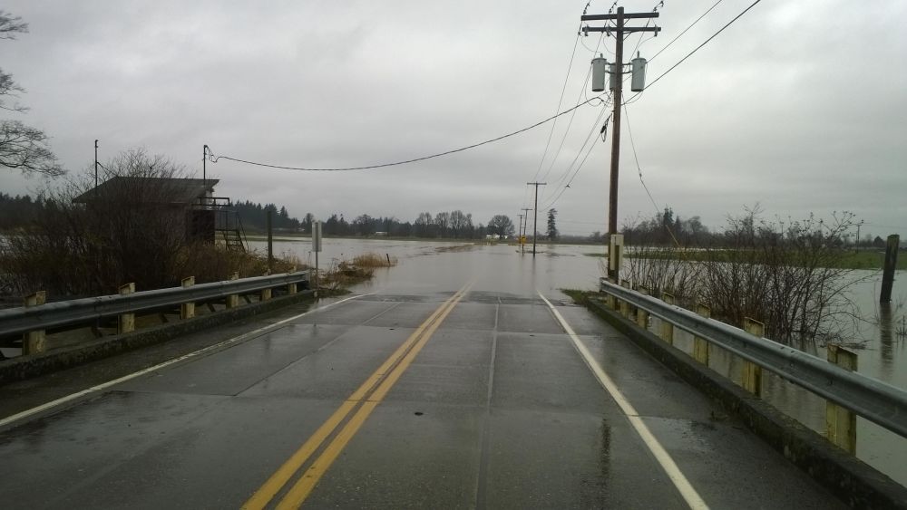
There is a Flood Watch in effect for the Nooksack River at Ferndale (and other locations) until 10AM Sunday which means conditions are favorable for flooding but flooding is not imminent or occurring. According to the National Weather Service hydrological forecast for the Nooksack River at Ferndale, the river is expected to rise quickly today and peak just over the flood stage of 19 feet late Saturday. It is expected to reach 17 feet later today and it is at that point the river begins flooding at its lowest points, flooding adjacent pasture lands and impacting roads in those areas.
Drivers are warned to be alert for water and debris over roadways near the Nooksack River and nearby streams.
Discover Ferndale will post updates including road closures when the information becomes available.
Discover more from Whatcom News
Subscribe to get the latest posts sent to your email.