UPDATE 6:40am
The National Weather Service has ended the Wind Advisory for the Whatcom County area. Click here for more details.
Original Story
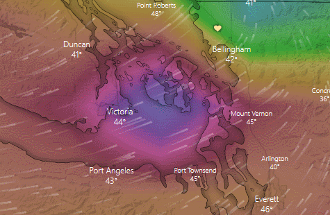
The wind storm forecast to arrive in Whatcom County this morning has already wrecked havoc in central western Washington areas with wind gusts reported over 60mph.
A Wind Advisory remains in effect for the Ferndale and other nearby inland areas with southwest to west sustained winds of 20 to 35mph and gusts up to 50mph expected for an hour or 2 once the low pressure area arrives.
Forecasters say to expect a quick burst of south to west winds as the low passes in the next few hours. Winds will then rapidly ease later this morning as the low pressure area moves north into Canada.

Click for more information

Click for more information
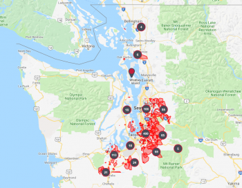
As of 3am, Seattle City light reported nearly 50,000 customers were without power, Tacoma Public Utilities reported 12,000 and Puget Sound Energy reported over 200,000 of their customers were impacted.
The National Weather Service reported the strongest gusts as of 2:45am had been reported at the following locations.
| Location | Speed | Time/Date | Lat/Lon |
| JBLM | 61 MPH | 0132 AM 01/06 | 47.13N/122.48W |
| Hoquiam Airport | 60 MPH | 0100 AM 01/06 | 46.97N/123.93W |
| SeaTac Airport | 60 MPH | 0159 AM 01/06 | 47.44N/122.31W |
| Ft. Lewis | 58 MPH | 1245 AM 01/06 | 47.08N/122.58W |
| 1 mile S of Eastgate | 56 MPH | 0230 AM 01/06 | 47.55N/122.13W |
A Severe Thunderstorm Warning was issued about 4am for areas in Snohomish and Skagit Counties until 4:30am.
According to a weather station located near Ferndale High School, winds abruptly began increasing shortly after 3am this morning with the strongest gust as of 4:30am reported at 47mph at about 3:30am. As of 4:40am, winds were from the southwest after shifting from northerly at midnight to southeasterly by 3am.
Discover more from Whatcom News
Subscribe to get the latest posts sent to your email.