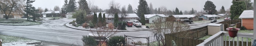
FERNDALE, Wash. — This afternoon’s snow event left behind varying amounts of snow accumulation across western Whatcom County, including the Ferndale area.
The deepest accumulations during the 2.5-hour snow event today, December 21st, were reported as a few inches while others areas reported a dusting.
As of 3pm, I-5 and most well-traveled roads were reported to be bare and wet while temperatures were reported to be in the mid-30s.
Whatcom County Director of Emergency Services John Gargett issued a briefing this afternoon that included what can be expected given the current weather forecasts.

Click for more information

Click for more information
While most of the snow is melting on road surfaces where there is traffic, temperatures will begin dropping and accumulations of slush on roads may take place. The good news is that precipitation will end later tonight.
High temperatures are stuck in the low to mid 30s and will likely start dropping shortly. Therefore, slush on the roads will stick around a little longer. There could be some northerly winds with gusts to around 25 mph.
For tomorrow and Wednesday, we’ll have partly cloudy skies with lighter winds. Temperatures are once again predicted to reach the low 40s with evening lows around 30 degrees with some upper 20s in the county. Frost or even some ice on the roads is possible where water is standing.December 20, 2020 Emergency Management Daily Briefing for Whatcom County – 3pm update
About 2:30pm snow stopped falling in the Ferndale area and areas to the north while Bellingham began seeing its first snowflakes and some light accumulation to the south.
Discover more from Whatcom News
Subscribe to get the latest posts sent to your email.