WHATCOM COUNTY, Wash. — The Seattle office of the National Weather Service (NWS) has issued a wind advisory between 2pm today, Tuesday, October 28, 2025, and midnight tonight due to expected southeast wind gusts up to 45mph.
A high-pressure weather system is expected to pass over the area tomorrow bringing a temporary break from wind and rain later in the day.
Rain is expected to increase Friday night as an atmospheric river initially takes aim at Vancouver Island, the Olympic Peninsula, and northern portions of the Cascades. The tap of moisture is then expected to slowly sag southward across the CWA during the day on Saturday.
Conditions are expected to remain unsettled into the beginning of next week as the flow turns more zonal and a number of weaker systems move across the area.
Advertisement
Click for more informationAdvertisement
Click for more information– National Weather Service (October 28, 2025)


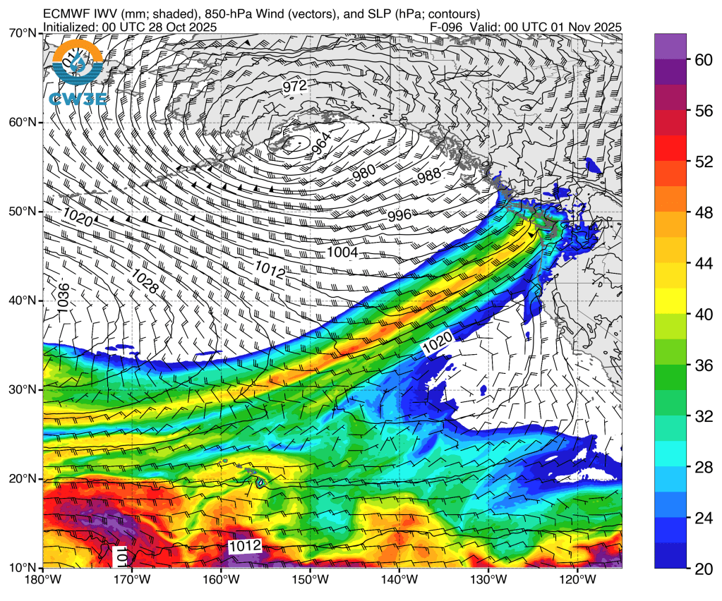
Source: Center for Western Weather and Water Extremes
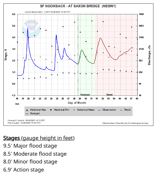
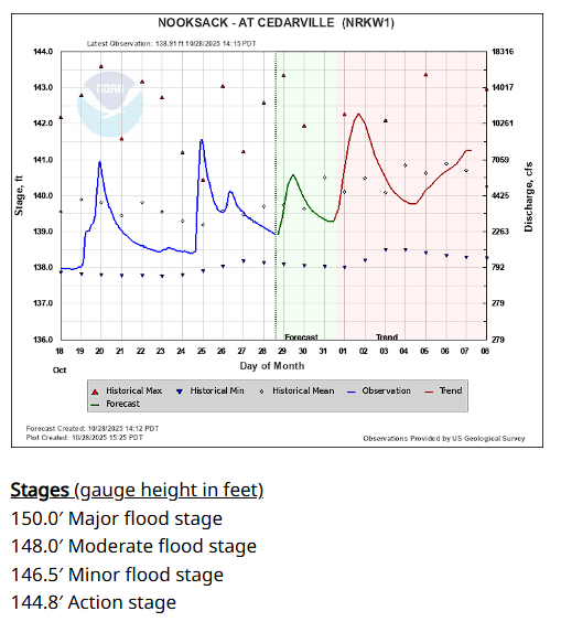
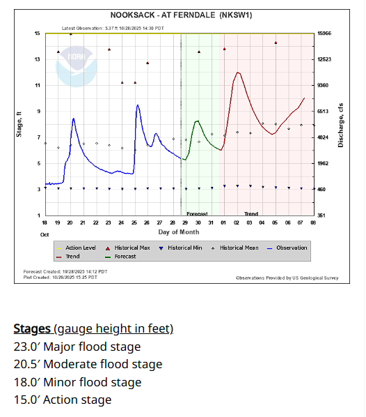
Rain accompanying the expected weather systems are expected to raise the level of the Nooksack River but current forecasts remain well below flood stage as shown below.
Whatcom News readers are encouraged to stay up to date with current weather alerts and forecasts and air quality readings for their specific Whatcom County locations along with tide tables via the Whatcom News Weather page.
River level forecasts can change frequently so motorists and property owners are advised to monitor the Nooksack River level forecast.
Discover more from Whatcom News
Subscribe to get the latest posts sent to your email.