UPDATE 11/17/15 10:30am
The Nooksack River level forecast at Ferndale has been revised to cresting just over flood stage (19 feet). This is slightly lower than previous forecasts that had it cresting at nearly 20 feet.
UPDATE 11/17/15 8:30am
The NWS has revised today’s Wind Advisory to a High Wind Warning with the possibility of SE winds at 20 to 40 mph with gusts to 60 mph.
ORIGINAL STORY
The windstorm that rolled in today, November 16th, packed a few gusts over 50 MPH but spared the area from any significant power outages. We had been warned to expect stronger winds from the next storm but perhaps that was erring on the side of caution.

Click for more information

Click for more information
According to a weather station located near the high school, there were several gusts between 40 and 50 MPH after noon and a few over 50 MPH after 3pm.
Earlier forecasts for tomorrow’s windstorm were for gusts closer to 75 MPH. But recent updates from the National Weather Service have reduced the alert from a high wind watch to a wind advisory with gusts up to 50 MPH. Much like today’s windstorm, the timing for tomorrow’s is for winds to pick up in the late morning and peak mid-afternoon.
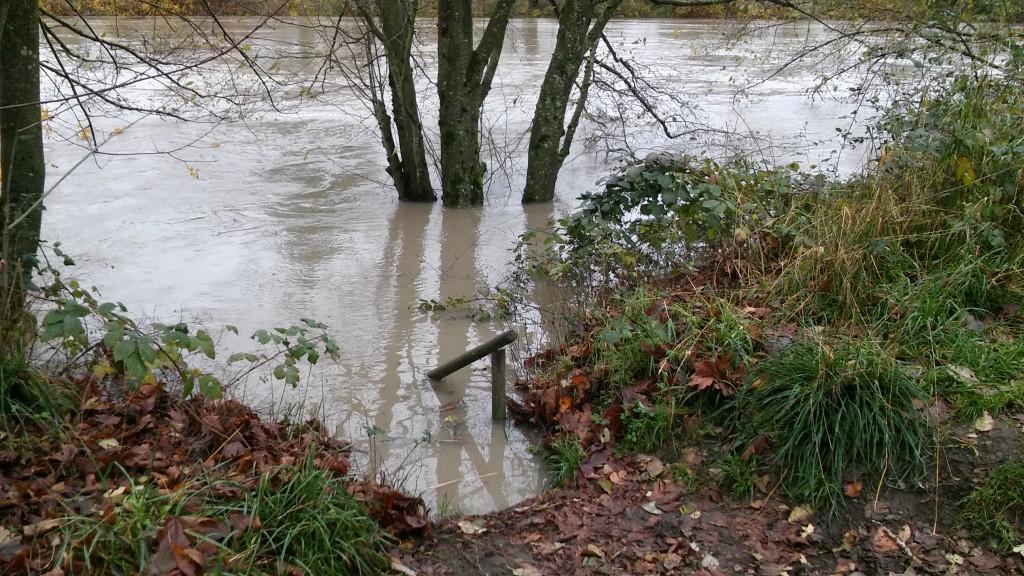
These storms have brought with them lots of rainfall, especially in the mountains. Given recent rains and flooding have already saturated the ground both in the mountains and in the lowlands, the next wave of rains are expected to result in higher river levels than what caused last weekend’s minor flooding.
Last weekend, November 14th and 15th, the Nooksack River and adjacent creeks and streams overflowed their banks in the Ferndale area causing minor flooding and a few road closures. The Nooksack River crested at about 17.5 feet during that event.

Click for more information

Click for more information
Another flood event is expected from Tuesday to Thursday this week with the river currently forecast to crest Wednesday at close to 20 feet. NWS has issued a flood watch from tonight until late Wednesday.
More and longer lasting road closures are a possibility this week in comparison with last weekend’s flooding. Closing public lands (e.g. parks) near the river due to flooding is also a possibility at these higher river levels.
Discover Ferndale will be monitoring and reporting flooding impacts, including road closures, as information becomes available.
Discover more from Whatcom News
Subscribe to get the latest posts sent to your email.