WHATCOM COUNTY, Wash. — A tsunami advisory was issued for the Washington Coast including the Strait of Juan De Fuca and the San Juan Islands at approximately 5am, today, Saturday, January 15th, as a result of an undersea volcanic eruption near the Tonga Islands in the south Pacific Ocean.
Update 4:35pm – The tsunami advisory for Washington state has been canceled. No tsunami danger presently exists for this area.
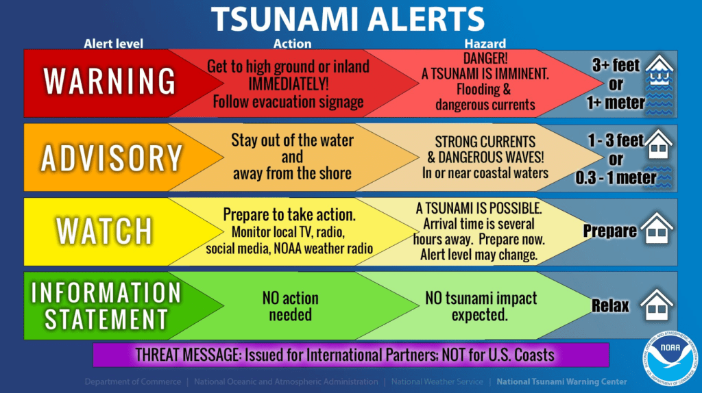
A tsunami advisory is issued when a tsunami with potential to generate strong currents/waves dangerous to those in/very near the water is imminent, expected, or occurring. The threat may continue for several hours but significant inundation is not expected.
The first wave of a tsunami may not be the largest or the most destructive. Stay away from the beach for the duration of the tsunami event.
Advertisement
Click for more informationWashington Emergency Management DivisionAdvertisement
Click for more information


Whatcom County Division of Emergency Management Deputy Director John Garget said wave heights from the expected tsunami are forecast to be 1 to 2 feet high for the outer coast of Washington and could possibly impact our coastal areas. These waves can also produce strong currents. Waves are expected to last for 4 to 5 hours after the first wave.
Gargett added that, while the risk appears to be low, residents are advised to stay off the beaches of Whatcom County until the tsunami advisory is lifted.
Tsunami sirens have not sounded since this situation is only at advisory level and expected waves appear to be minimal. Typically, sirens are activated during a tsunami warning (see graphic below for criteria).
Whatcom County Ferry Department officials said at 9am they did not expect ferry service to be interrupted and were continuing to monitor the situation.

Click for more information

Click for more information
Officials advise to take the following actions if you are in a tsunami advisory area.
- Move out of the water, off the beach, and away from harbors, marinas, breakwaters, bays and inlets.
- Be alert to and follow instructions from your local emergency officials because they may have more detailed or specific information for your location.
- Boat operators,
- Where time and conditions permit, move your boat out to sea to a depth of at least 180 feet.
- If at sea avoid entering shallow water, harbors, marinas, bays, and inlets to avoid floating and
submerged debris and strong currents.
- Do not go to the shore to observe the tsunami.
- Do not return to the coast until local emergency officials indicate it is safe to do so.
Advisory level tsunami waves were observed at the Hawaiian Islands measuring between 0.4 and 2.7 feet more than 3 hours. Initial waves were observed in Alaskan Aleutian Island locations at up to 13.75 inches and later grew to nearly 3 feet.
Tsunami wave heights are in addition to expected tide levels.

Times when tsunami waves are estimated to reach Washington locations are as follows.
- Long Beach 8:35am
- La Push 8:45am
- Neah Bay 8:50am
- Westport 8:50am
- Moclips 8:55am
- Port Angeles 9:30am
- Port Townsend 9:55am
As of 7am, tsunami advisories due to Tonga Island undersea eruption are in effect for the following areas.
- CALIFORNIA, The coast from The Cal./Mexico Border to The Oregon/Cal. Border including San Francisco Bay
- OREGON, The coast from The Oregon/Cal. Border to The Oregon/Wash. Border including the Columbia River estuary coast
- WASHINGTON, Outer coast from the Oregon/Washington border to Slip Point, Columbia River estuary coast, and the Juan de Fuca Strait coast
- BRITISH COLUMBIA, The north coast and Haida Gwaii, the central coast and northeast Vancouver Island, the outer west coast of Vancouver Island, the Juan de Fuca Strait coast
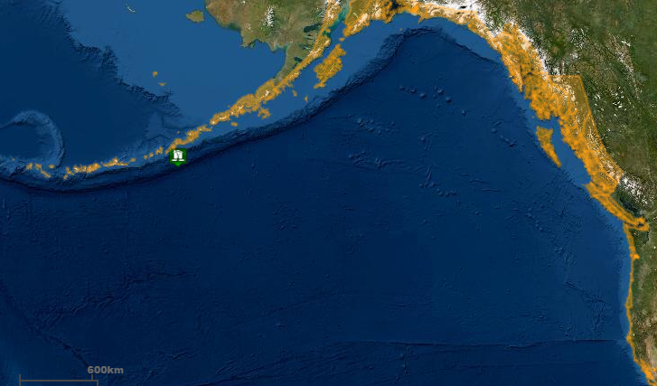
- SOUTHEAST ALASKA, The inner and outer coast from The BC/Alaska Border to Cape Fairweather, Alaska (80 miles SE of Yakutat)
- SOUTH ALASKA AND THE ALASKA PENINSULA, Pacific coasts from Cape Fairweather, Alaska (80 miles SE of Yakutat) to Unimak Pass, Alaska (80 miles NE of Unalaska)
- ALEUTIAN ISLANDS, Unimak Pass, Alaska (80 miles NE of Unalaska) to Attu, Alaska including the Pribilof Islands
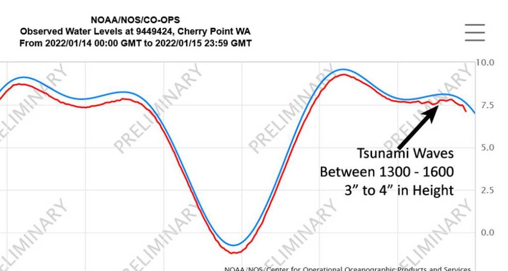
“Minor” tsunami waves can be seen between 1pm and 4pm on the Cherry Point tide gauge (below).
Discover more from Whatcom News
Subscribe to get the latest posts sent to your email.