WHATCOM COUNTY, Wash. — Many Whatcom County residents are waking to the sound of rainfall atop recent snow accumulations coated with ice this morning, Friday, December 23rd.
Freezing rain has arrived in western Washington and will continue to bring icy conditions to the region throughout the morning hours. Latest radar imagery shows the bulk of the precipitation having already cleared the majority of the Sound this morning and currently pushing into the Cascades. The exception remains [in] Whatcom county, where a heavier band of precipitation, currently moving eastward across Vancouver Island, will likely continue to impact the area over the next 1-2 hours. Additional ice accumulations of around a 0.10 of an inch will be possible across the area as a result. Showers following the bulk of precipitation will continue through the remainder of the day, though expect freezing rain to gradually transition to rain across the region this afternoon from south to north. Areas across Whatcom County will be the last to see that transition for the lowlands. With cold air in place and easterly winds persisting across the Cascade gaps, can expect any freezing rain impacts to linger a bit longer across the mountain passes as well. All in all, conditions are icy out there. It`s best to avoid driving if possible.
In addition to the freezing rain impacts this morning, today will mark the start of a warming trend in the forecast. Temperatures this afternoon will slowly warm into the upper 30s and low 40s.
The first in a series of warmer systems will then impact the region on Saturday, bringing periods of heavy rain to western Washington. This will pose a whole new set of hazardous weather impacts to the area, including small stream and urban flooding potential due to rain-on-snow impacts and the potential for sharp rises on area rivers.
Advertisement
Click for more informationNational Weather Service Seattle office (6:16am – December 23, 2022)Advertisement
Click for more information


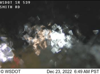
As of 6:30am, according to WSDOT traffic cameras in Whatcom County, most motorists are paying heed to warnings to stay home as indicated by the relative lack of vehicles in the images.
Law enforcement were being kept busy by reports of stranded, disabled and crashed vehicles according to emergency radio transmissions.
Due to the large amount of freezing rain and icy conditions on roadways in the Puget Sound region, we are advising to delay all non-essential travel at this time. Our crews are still treating the roads, but for the safety of our crews and all other travelers, until weather and roadway conditions improve, delaying non-essential travel is advised. Washington State Department of Transportation (December 23, 2022)
Winter storm warnings are in place for Whatcom County lowlands, until 10pm tonight, and higher elevations, until 10am Saturday. The lowlands can expect, “Heavy mixed precipitation, including freezing rain. Additional ice accumulations of around a tenth of inch possible.” The higher elevations can expect, “Heavy mixed precipitation. Additional snow accumulations of up to 4 to 8 inches and ice accumulations of up to one quarter of an inch possible.”

Click for more information

Click for more information
While initial precipitation may be as snow or freezing rain, a shift to a much warmer air mass Friday night into Saturday will likely lead to rain falling on existing snow. This could lead to some urban flooding concerns as drainage systems may not be able to keep up with the increased runoff from the rain and the melting snow. Additionally, some rises on mainstem rivers may also result, but widespread river flooding is not expected through Saturday night. National Weather Service Seattle office (December 22, 2022)
Snowmelt and rain will become trapped in areas where it cannot drain as snow is blocking many drains and culverts and ditches are full of snow. Water can become fairly deep where it cannot drain so hydroplaning is a definite risk. If you are able to clear snow from drain areas, please do so. Landslide and avalanche risk will also increase as snow melts. Whatcom County Division of Emergency Management (December 22, 2022)
Whatcom News readers are encouraged to stay up to date with current weather alerts and forecasts and air quality readings for their specific Whatcom County locations along with tide tables via the Whatcom News Weather page.
River level forecasts can change frequently so motorists and property owners are advised to monitor the Nooksack River level forecast.
Discover more from Whatcom News
Subscribe to get the latest posts sent to your email.