Forecasters with the National Weather Service Seattle office have upgraded yesterday’s a High Wind Watch to a High Wind Warning that will be in effect beginning 6pm today, Friday, March 13th, until 12pm, noon, tomorrow.
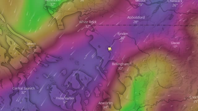
Sustained northeasterly winds of 25 to 45mph with gusts up to 60mph are expected throughout western Whatcom County. The strongest winds are expected closer to the US-Canada border.
Weather forecast computer models show northeasterly wind speeds remaining gusty while slowly declining beginning Saturday afternoon and continuing through Sunday evening.
The Fraser Valley outflow winds are expected to bring cold temperatures into the area as was reported yesterday. Overnight lows in the 20s are expected tomorrow morning and Sunday morning and in the low 30s Monday morning. While partly cloudy skies are forecast into Sunday, no precipitation is expected.
Clear skies are forecast for Monday and Tuesday with high temperatures climbing back up toward the 50s but lows will return to near or below freezing.
Discover more from Whatcom News
Subscribe to get the latest posts sent to your email.