WHATCOM COUNTY, Wash. — After 3 weeks of multiple atmospheric rivers pulling warm air along with heavy rains soaking and creating havoc across many places in Whatcom County, today’s weather seems closer to normal as it transitions Whatcom County to more colder temps and little chance of rain.
A brief break in the weather tonight and Friday before the next system arrives late Friday night into Saturday. This system will be much cooler than the previous ones in the last week. Additional fronts will reach the area Monday and again Wednesday.National Weather Service Seattle office (December 2, 2021)
The next weather system is expected to arrive late Friday night or early Saturday morning with precipitation amounts expected to be “way less than what we have seen lately,” according to forecasters.
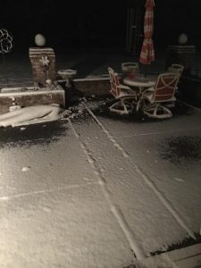
But as low temperatures begin to dip into the 30s, and even 20s in some locations, precipitation arriving during these colder periods could appear as snow or a snow-rain mix in the Whatcom County lowlands according to computer weather forecast models. The possibility of minimal snow begins Saturday morning and continues into next week. No accumulation of snow is expected during this time.
Whatcom News readers are encouraged to stay up to date with current weather alerts and forecasts and air quality readings for their specific Whatcom County locations along with tide tables via the Whatcom News Weather page.
Discover more from Whatcom News
Subscribe to get the latest posts sent to your email.