WHATCOM COUNTY, Wash. — High tide arrived in strength today, Tuesday, December 27th, aided by King Tide heights, pushed by southerly winds and added to by a low-pressure system offshore.
The Whatcom County Division of Emergency Management (DEM) said in a 9am email, “the King Tide plus storm surge caused by a deep low pressure system off the coast of WA will push the overall tide level to around 12.3 feet overall.”
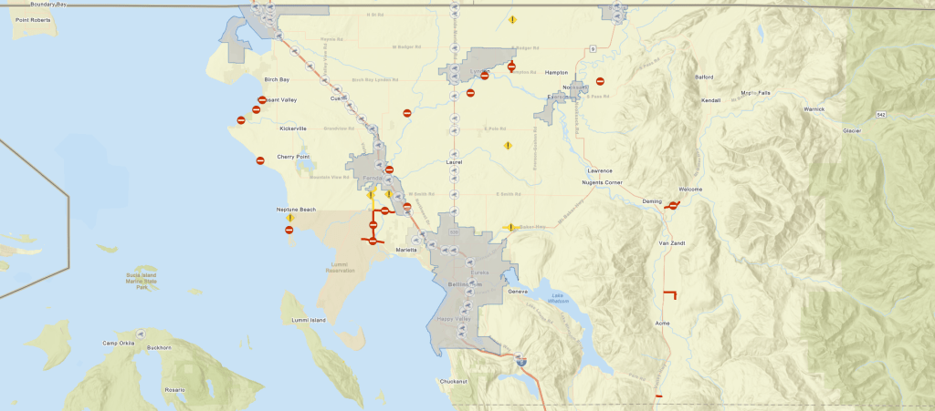
High tide was expected to reach Cherry Point, located between Birch Bay and Sandy Point, about 9:15am.
A coastal flood advisory has been in effect since 8am today and is currently scheduled to expire at 1pm. It warned of the potential for flooding of low-lying areas along the coastal areas of Whatcom County.

Click for more information

Click for more information
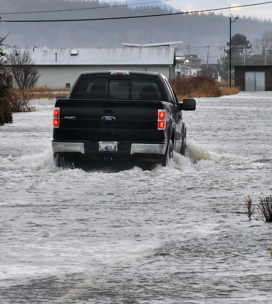
A 26-year resident of Sandy Point said she had not experienced the level of flooding that occurred there today. She saw several cars with occupants who appeared stuck between flooded sections of road and waiting for either a rescue or for the floodwaters to recede.

Occupants of a passenger vehicle were rescued by neighbors after their vehicle became disabled in the rising water forcing them to climb to the roof.
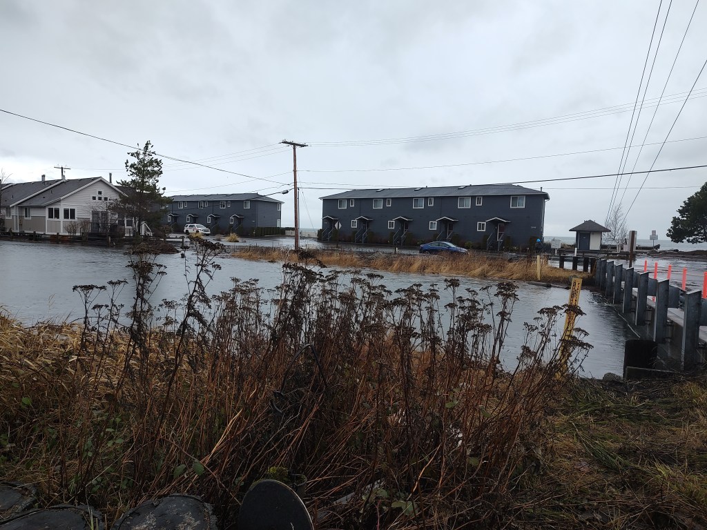
Similar scenes were reported at Birch Bay. While the newly constructed berm kept the waves and water at bay, water flowing into Terrell Creek caused flooding that left some properties flooded and roads closed due to water and debris over the roadways.
North Whatcom Fire & Rescue Division Chief Shaun Ward told Whatcom News that while they were kept busy by numerous dispatches to calls to assist flood victims, no injuries needed treating and no patients required transportation to the hospital. Firefighters did find themselves dealing with boots full of water upon returning to their fire stations.

Click for more information

Click for more information

About 11:30am, Whatcom County Parks and Recreation announced the closure of Hovander Homestead Park “due to current conditions and flood forecast.” The announcement added, “The park is anticipated remain closed at least through Wednesday, December 28th. The forecasted flood level is anticipated to cause trails, fields, and the main parking lot at Hovander to be inundated with flood waters.”
The gates at VanderYacht Park in Ferndale were closed by 11:30am today.
City of Bellingham officials closed the intersection of Roeder Avenue and Squalicum Way about 10:45am due to high water on the roadway. It was later reopened about noon.
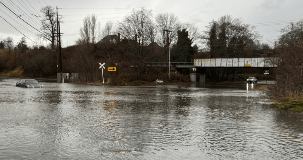
Whatcom County Public Works reported numerous roads impacted by flooding and downed power lines. They included Birch Bay Drive between Alderson and Point Whitehorn Roads, Sucia Drive, Marine Drive between Lummi Shore Drive and Rural Avenue, Slater Road between Ferndale Road and LaBounty Drive, Hannegan Road at the Lynden city limits and Goodwin Road south of Sorenson Road.
DEM announced about 12:30pm that the American Red Cross had established a temporary shelter for those displaced as a result of the impacts of the weather at the Cordata Presbyterian Church, 400 Meadowbrook Court, in Bellingham. “If water is threatening your home and you must leave, consider this shelter.”
Discover more from Whatcom News
Subscribe to get the latest posts sent to your email.