
UPDATE 8/3/17 12pm – Click here for air quality update
Original Story
There has been a detectible haze in the sky since sunrise and firefighters in Whatcom County have been getting calls to investigate the cause of smoke detected in areas ranging from near the border to south Bellingham.
PNW Smoke Cooperators report a change in wind direction is bringing smoke from wildifires burning in BC’s interior region down over western Washington. While many air monitoring stations elsewhere have begun showing deteriorating air quality and conditions, the station in the Ferndale area remains in the “Good” range.
Northwest Clean Air Agency reported last night that conditions will likely get worse before they improve. “Air quality could be unhealthy at times in particular on Tuesday and Wednesday. In addition, the hot, sunny weather could add complications by increasing levels of ground-level ozone that increase the chance of breathing problems.”

Click for more information

Click for more information
Today The Washington Department of Ecology issued an air quality alert for northern Puget Sound areas which will remain in effect until noon Thursday. Air quality is expected to range between “Good” and “Unhealthy for Sensitive Groups.”
An animated map provided on Canada.ca shows predicted smoke movement from the Canadian fires through tomorrow.
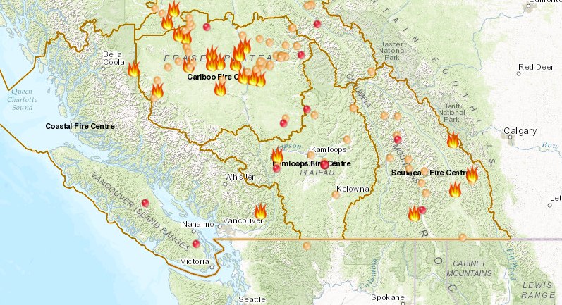
BC has been dealing with over 150 wildfires in the interior region since early July and nearly 50,000 people have been forced to evacuate to safety as a result.
Discover more from Whatcom News
Subscribe to get the latest posts sent to your email.