
FERNDALE, Wash. — As predicted, afternoon rains transitioned to rain and snow and then to simply snow by this evening, Sunday, January 12th.
As of 7:30pm, snow was beginning to accumulation was being reported while the temperature was report around 30°. Tonight’s low is expected to reach 20° by 6am.
Snow is expected to continue being a possibility into Monday with the potential for an inch or 3 by morning. A Winter Storm Warning remains in effect until 3am Monday.
In addition to the cold temperature and threat of snow accumulation, powerful northeasterly winds remain a possibility. A High Wind Warning is in effect until 7am and expects sustained winds of 25 to 40mph with gusts up to 60mph.

Click for more information
While the weather had yet, as of 7:30pm, begun to impact roads in the Ferndale area, things are reported to be much different south of Bellingham.
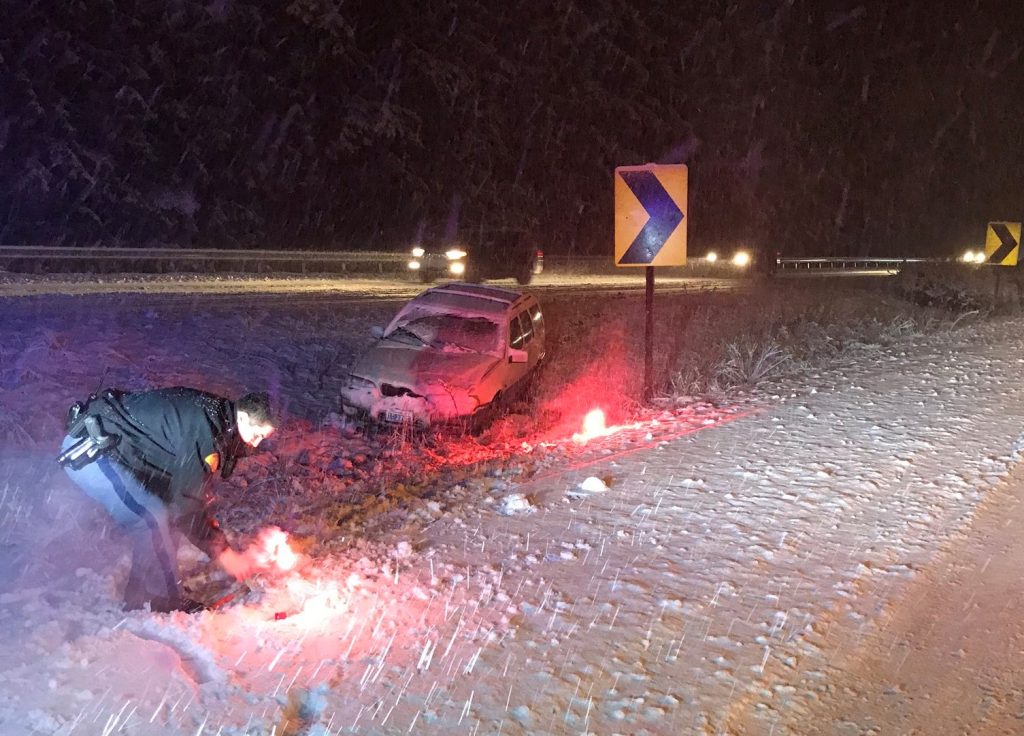
Washington State Patrol Trooper Heather Axtman said, “Collisions are continuing at a high rate within south Whatcom County. Troopers are throughout the area clearing collisions and helping vehicles out of the ditches.” Washington State Department of Transportation snowplows were reported to be out and clearing the interstate and state routes.
Share your photos and videos of snowfall around Ferndale. Text them to 360-223-1438 or (much preferred) upload them by clicking here.
Discover more from Whatcom News
Subscribe to get the latest posts sent to your email.
Salt the roads and solve the problem.
The winds blow the salt away before it does much good, so be careful for ice even when they’re salting the roads.
stay safe state patrol, your hard to replace !!!!