WHATCOM COUNTY, Wash. — As of 2am, November 15th, first responders were busy providing evacuation services, rescuing stranded drivers and posting signage on the many flooded roads across Whatcom County.
Heavy mountain rain and snow melt have pushed the Nooksack River levels up into official minor and moderate flood stage in all forks and in the main channel. Heavy lowland rains throughout the county have saturated the soil and resulted in surface water and creek and stream flooding. A weather monitoring station in Ferndale reported about 3 inches of rainfall and another in Glacier reported about 6 inches during the 24-hour period ending 2am today.
While National Weather Service forecasters in the Seattle office say the heavy rains over Whatcom County and the northern Cascades will end this morning, they also warn the resulting flooding could reach record levels.
The Nooksack River will cause major near record flooding downstream through Lynden. Deep and swift flood waters will inundate farm lands…roads…and residential areas. The flood may overtop levees. In addition…flood waters could overflow and flood the Sumas drainage. Flooding will occur all along the river including headwaters…tributaries…and other streams within and near the Nooksack River Basin.
Advertisement
Click for more informationNational Weather Service statement 2am, November 15, 2021Advertisement
Click for more information


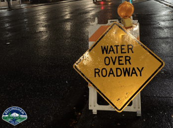
As of 4am, water and debris over roadways have resulted in the closure of the following primary roads as well as many other locations too numerous to include.
- Acme – Valley Highway (SR9) north of Acme
- Ferndale – Slater Road between LaBounty Drive and Ferndale Road
- Bellingham – Marine Drive between Rural Avenue and Lummi Shore Drive
- Bellingham – Aldrich Road between Smith Road & Larson Road and between Lange Road & the Bellingham city limits
- Bellingham – Iowa Street at the I-5 northbound on- and off-ramps
- Everson – Emerson Road at Massey Rd
- Everson – Goodwin Road north of Hopewell Road & north of S Pass Road
- Everson – Mack Road between Ellis Avenue and Oat Coles Road
- Everson/Nooksack – E Main Street between Shuksan Street and Nooksack Avenue
- Everson – E Badger Road (SR546) at multiple locations
- Everson – Lawrence Road (SR9) at E Hoff Road
- Lynden – Hannegan Road south of the Lynden city limits
- Sumas – Reese Hill Road (SR547) between Eagle Roost Drive and Sumas Road
Officials in Sumas reported late yesterday that the Nooksack River had overflowed its banks in Everson and “the water has been working it’s way north to Sumas ever since.” Around 8:30pm they reported, “It just crossed over Tom Road. It is moving a little faster than we expected. It could arrive in Sumas as early as 11pm tonight.”
Law enforcement dealing with multiple occupied and partially submerged vehicles on E Badger Road suggested all roads into Sumas would be closed this morning.
Officials with Ferndale Public Works told Whatcom News they expect neighborhoods around VanderYacht Park will be inundated by flood water later today. They were expecting to close Washington Street, Portal Way, 2nd Avenue and Bass Drive when that occurred. The river level in Ferndale is expected to reach 21.75 feet by Tuesday, lower than the 22.76 foot level recorded during a flood event on January 8, 2009.

Click for more information

Click for more information
Other Ferndale area expected impacts include the closure of VanderYacht Park, Hovander Homestead Park, Tennant Lake Interpretive Center and the Fragrance Garden.
NWS issued a wind advisory this morning that will be in effect from 10am to 7pm. In it, they warn to expect sustained westerly winds of 35mph to 45mph with gusts to 50mph. The advisory area includes western Whatcom County and San Juan County.
These winds are forecast to coincide with an over 9-foot high tide about 2:30pm this afternoon. The combination of the high westerly winds and high tide can result in damaging tidal flooding in low-lying coastal areas including Sandy Point and Birch Bay.
EDITORIAL NOTE: Based on emergency radio traffic this morning, it is inadvisable to drive anywhere in the county due to surface water flooding and river flooding. Search and Rescue teams are being dispatched to rescue numerous motorists reported to have been swept off roads as well as others stuck in rising water in vehicles with nonfunctioning electrical systems. These situations are happening in both rural and urban areas in the county.
Discover more from Whatcom News
Subscribe to get the latest posts sent to your email.