WHATCOM COUNTY, Wash. — Weather forecasters on both sides of the US-Canada border are expecting another rain event beginning late Wednesday through Friday or Saturday.
The National Weather Service office in Seattle issued a hydrologic outlook statement for Whatcom, Skagit, Snohomish, Mason and King Counties forewarning that a weather system is expected to bring rain to these areas Thursday and Friday. This is expected to result in rising snow levels and heavy rain that will cause rivers to rise with flooding possible. Subsequent weather systems are possible over the weekend and into early next week.
Environment Canada forecasters issued a special weather statement for Metro Vancouver and the Fraser Valley, particularly near the mountains, saying they are expecting 1.5 to 3 inches of rainfall late Wednesday through early Friday.
This storm will be shorter lived and less intense than the event over November 13-15, 2021. However, it will still bring moderate to heavy rain and strong winds. Additionally, freezing levels will rise above mountain tops on Thursday. This may worsen recent flooding and impact vulnerable landscapes and infrastructure.Environment Canada special weather statement (November 23, 2021)
Nooksack River level forecasts as of 8am today, November 23rd, (below) show the Saxon Bridge gauge on the south fork cresting below action state while the Cedarville and Ferndale gauges reach action stage while remaining below minor flood stage.
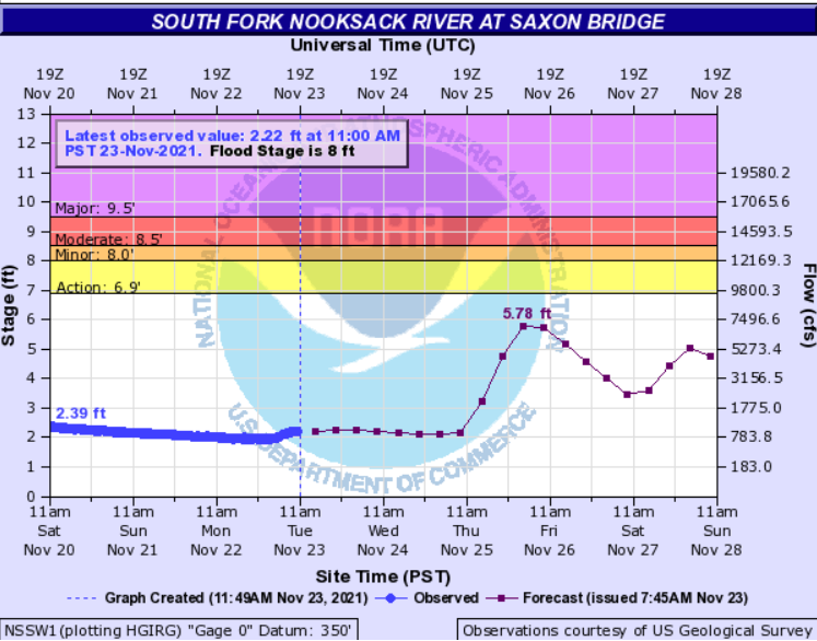
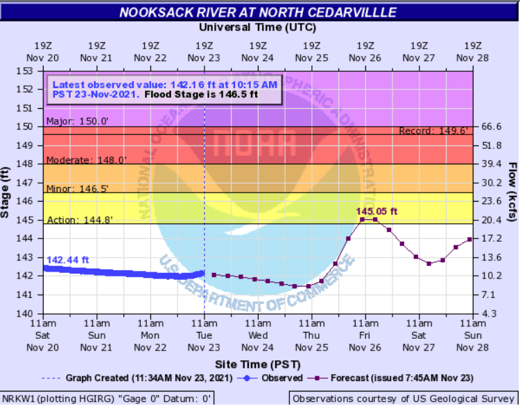
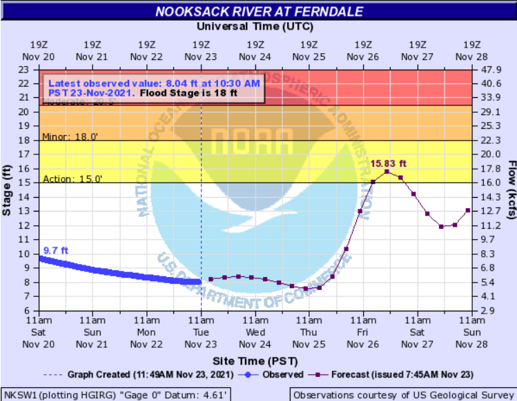
River level forecasts can change significantly. Property owners and motorists should monitor them frequently.
Discover more from Whatcom News
Subscribe to get the latest posts sent to your email.