WHATCOM COUNTY, Wash. — Forecasters with the National Weather Service’s Seattle office are forewarning of weather systems bringing continued precipitation and high winds across the western Washington region today, Tuesday, December 27th.
Active weather day for Western Washington with winds, some coastal flooding then some snow in the mountains tonight. High wind warnings this afternoon and evening for the coast, along the Strait of Juan de Fuca and from Seattle south in the interior. Calmer day Wednesday. National Weather Service Seattle office (December 27, 2022)
A 24-hour wind advisory is currently in effect until 1am tomorrow. This morning forecasters said to expect 35 to 40mph winds in Whatcom County lowlands and 35 to 40mph in the higher elevations. The winds are expected to begin in the late afternoon and continue into the evening hours.
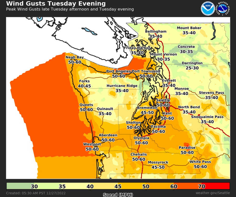
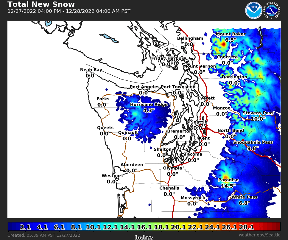
A winter weather advisory is in effect from 4pm today through 4am tomorrow for areas above 2,500 feet due to snow expected. Snow accumulations of 8 to 12 inches are expected with the strong wind gusts.

Click for more information

Click for more information
Flooding remains a concern in Whatcom County. A coastal flood advisory is in effect from 8am through 1pm today due to expected minor coastal flooding at low-lying Whatcom coastal areas.
Whatcom County Division of Emergency Management said via email this morning that the “King Tide plus” storm surge caused by a deep low-pressure system off the coast of Washington will push the overall tide level to around 12.3 feet. The wind has not materialized as NWS originally predicted but will pick up later this morning and continue overnight. Presently, the wind is from a south-southeast direction.
A flood watch is effect from 5am to 9pm today due potential flooding resulting from continued “excessive rainfall.”
Rain, heavy at times, through Tuesday. Ground conditions are already saturated from previous storms. The additional rain on Tuesday could push some [western Washington] rivers to flood stage later Tuesday into Wednesday morning.
Advertisement
Click for more informationNational Weather Service flood watch statement (December 27, 2022)Advertisement
Click for more information


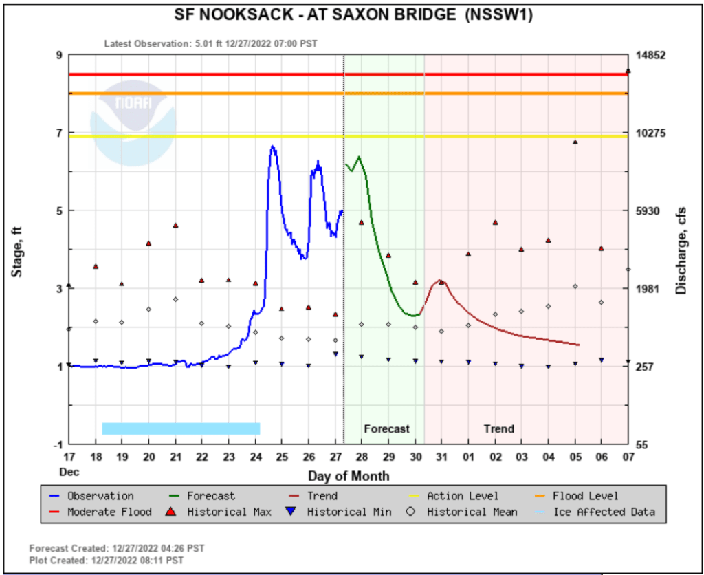
Current Nooksack River river level forecasts at key locations expect crest levels below flood stage except downstream at Ferndale where it is expected to crest about 8am tomorrow at about 19 feet, a foot inside minor flood stage.
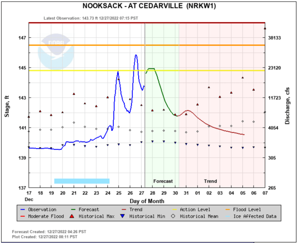
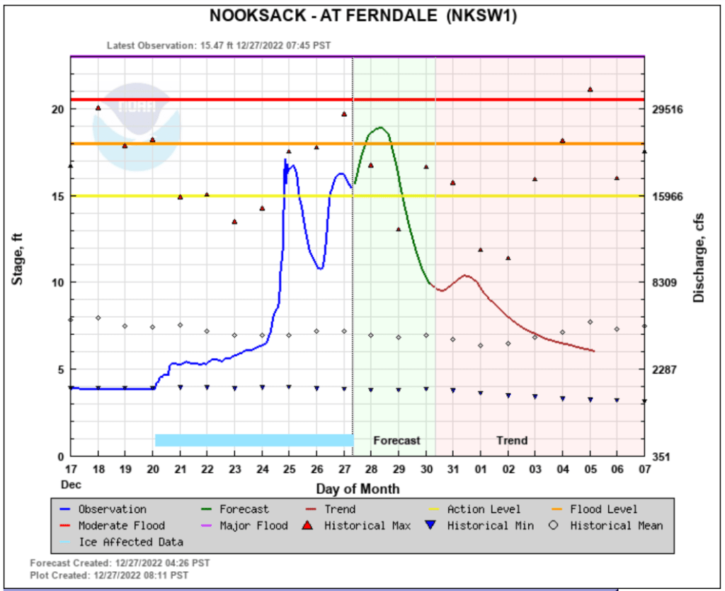
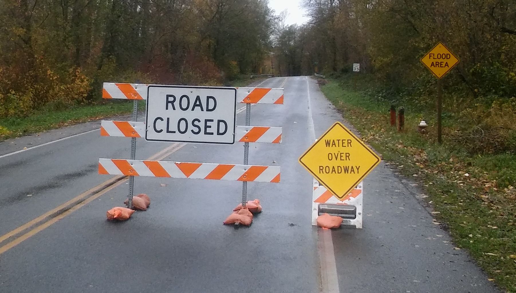
Whatcom County Public Works (WCPW) has reported Slater Road is closed (since December 25th) due to water and debris over the roadway after the river crested at about 17 feet in Ferndale.
Today, WCPW reports Hannegan Road has been closed between Riverview Road and Polinder Road due to water over the roadway.
Marine Drive is also closed due to flooding from Lummi Shore Drive/Road to Rural Avenue and several roads north of Lynden are reported to have water over the roadway but currently remain open to traffic.
Whatcom News readers are encouraged to stay up to date with current weather alerts and forecasts and air quality readings for their specific Whatcom County locations along with tide tables via the Whatcom News Weather page.
River level forecasts can change frequently so motorists and property owners are advised to monitor the Nooksack River level forecast.
Discover more from Whatcom News
Subscribe to get the latest posts sent to your email.