Aerial photos provide visual perspective over parts of Whatcom County flooding
By Staff on November 18, 2021 8:22am
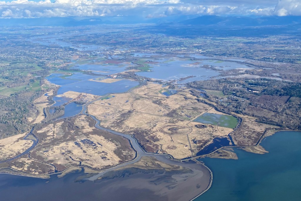
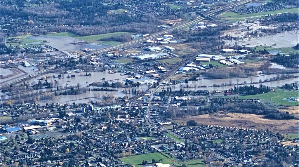
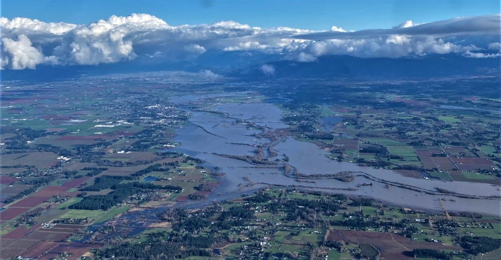
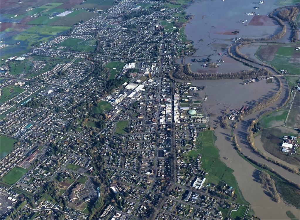
WHATCOM COUNTY, Wash. — The following photos provided to Whatcom News by a reader were taken shortly after noon Tuesday, November 16th, from an altitude of about 4,000-feet by a local amateur pilot. They document the expanse of the floodwaters about 6 hours after the Nooksack River crested in Ferndale in major flood stage range at nearly 24-feet.
View of Hale Passage, between Gooseberry Point and Lummi Island, from the north (November 16, 2021). Photo courtesy of Larry McCarterView of the north end of the Lummi Peninsula looking northeast – Lummi Reef Casino Hotel is slightly left of center (November 16, 2021). Photo courtesy of Larry McCarterView of Ferndale from the west (November 16, 2021). Photo courtesy of Larry McCarterView of downtown Ferndale from the northwest (November 16, 2021). Photo courtesy of Larry McCarterView of Ferndale to Bellingham Bay from the northwest (November 16, 2021). Photo courtesy of Larry McCarterView of Lynden from the southwest (November 16, 2021). Photo courtesy of Larry McCarterView over Lynden looking northwest (November 16, 2021). Photo courtesy of Larry McCarterView over Lynden looking northwest (November 16, 2021). Photo courtesy of Larry McCarterView of northbound traffic backup heading into Lynden via the Guide Meridian (November 16, 2021). Photo courtesy of Larry McCarterView of northbound traffic backup heading into Lynden via the Guide Meridian (November 16, 2021). Photo courtesy of Larry McCarterView looking south from Lynden toward Bellingham Bay (November 16, 2021). Photo courtesy of Larry McCarterView of flooding at Iowa Street northbound I-5 on- and off-ramps in Bellingham (November 16, 2021). Photo courtesy of Larry McCarter