WHATCOM COUNTY, Wash. — Environment Canada weather forecasters issued a special weather statement today, Saturday, January 21st, for areas along the US-Canada border and beyond forewarning of periods of snow over areas above 650 feet.
The weather statement says 3/4 to 2 inches of snow accumulation is possible in locations above 650 feet during the morning and into the early afternoon.
Error, group does not exist! Check your syntax! (ID: 11)A cold front will move onto the BC south coast on today bringing rain beginning in the morning. Rain may be mixed with snow for parts of the Lower Mainland before the temperatures rise this afternoon.
Closer to sea level, no significant accumulation is expected but there may be wet snow falling at times. Precipitation will ease this evening with the passage of the front.
Advertisement
Click for more informationEnvironment Canada special weather statement (January 21, 2023)Advertisement
Click for more information


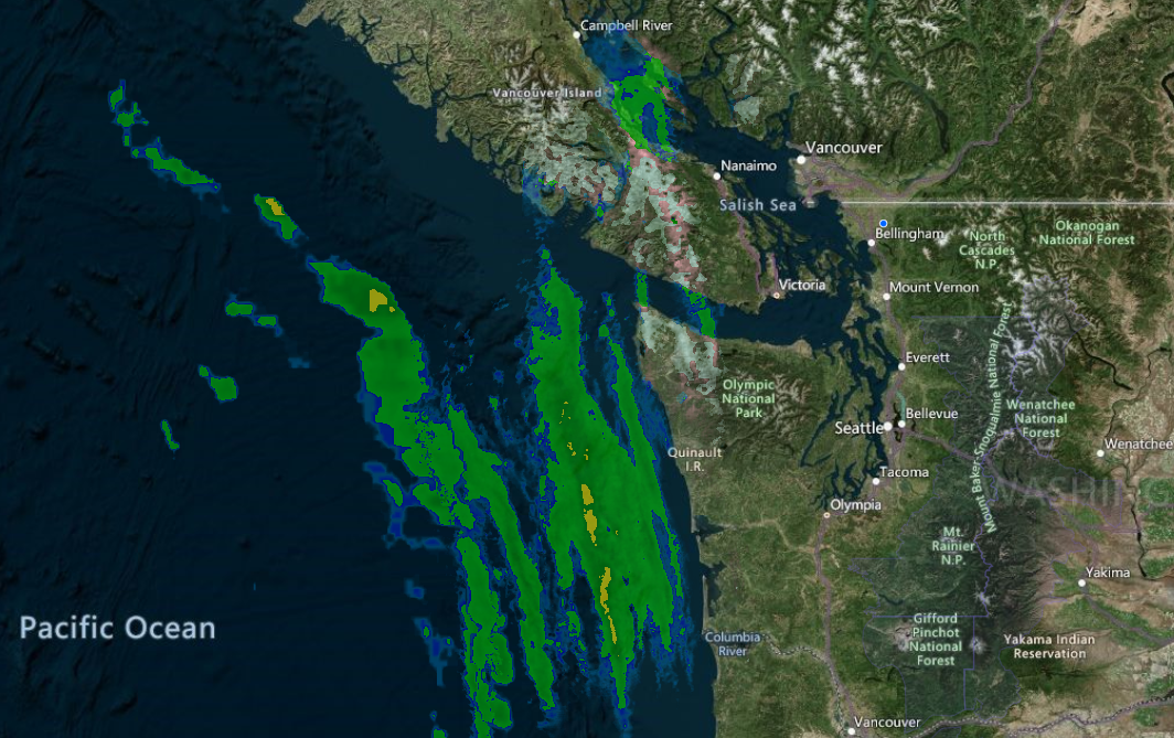
Waves of precipitation were visible on weather radar as they headed northeast toward Whatcom County this morning. The initial wave appeared as snow in the higher elevations over Vancouver Island.
National Weather Service Seattle office forecasters were less concerned about the possibility of frozen precipitation and warned of the possibility for strong winds with the approaching weather system.
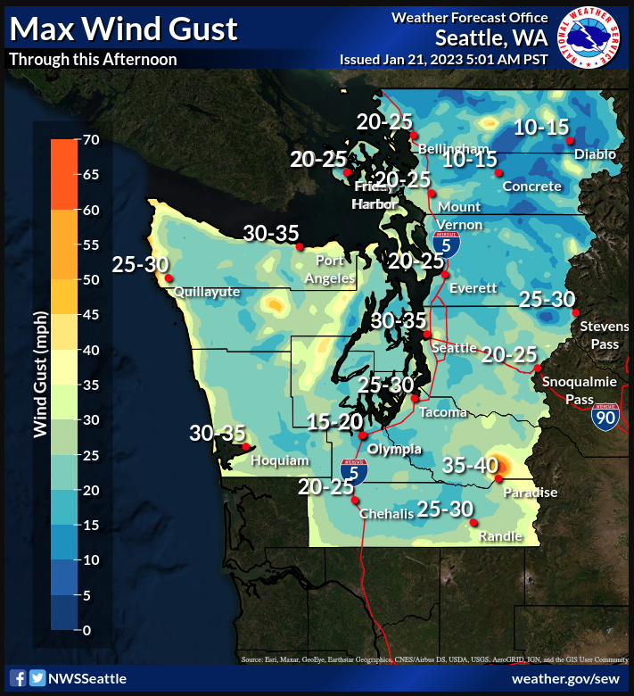
Rain will move onshore over the next few hours, with quick progression east over the area given the more zonal motion of the system rather than a northeast direction seen in some previous storm tracks. This looks to be a quick-hitter with most locations seeing a solid 4-5 hours of rain before things taper off.
Breezy southeasterly winds ahead of the low will really pick up after 8-9 am, with a quick shift to westerly winds along the front around the 4-5 pm timeframe. National Weather Service Seattle office (January 21, 2023)
Westerly winds pose a risk of flooding along Whatcom County coastal areas during high tides over the next 6 days.
Date Day Time Height January 21, 2023 Sat 06:21 AM 10.52 January 22, 2023 Sun 06:57 AM 10.69 January 23, 2023 Mon 07:31 AM 10.72 January 24, 2023 Tue 08:03 AM 10.66 January 25, 2023 Wed 08:34 AM 10.53 January 26, 2023 Thu 09:03 AM 10.31
Whatcom News readers are encouraged to stay up to date with current weather alerts and forecasts and air quality readings for their specific Whatcom County locations along with tide tables via the Whatcom News Weather page.
Discover more from Whatcom News
Subscribe to get the latest posts sent to your email.