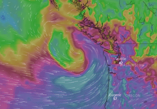
The National Weather Service office in Seattle issued a Special Weather Statement for Saturday due to expected high southerly winds across western Washington, including the Ferndale area, for most of the day.
High wind is possible, sustained winds of at least 40 mph or gusts to at least 58 mph, along the coast with less of a chance over the northern inland areas. Most other [western Washington] places exposed to southerly wind could have wind in the 20-30 mph range, with gusts 40 to 45 mph.
The Ferndale area is within the NWS’s definition of “northern inland area.”
These powerful winds will be the result of a low pressure system that is expected to form over the Pacific Ocean several hundred miles west of south Oregon and track northward. It is expected to produce damaging winds reaching 70mph over Oregon coastal areas as the system works its way northward.

Click for more information

Click for more information
The system is expected to dissipate as it comes ashore somewhere over Vancouver Island late Saturday.
As is often the case with these events, there is a degree of uncertainty with how the storm will track and how intense it will actually be.
A special weather statement is issued for hazards that have not yet reached warning or advisory criteria.
Discover more from Whatcom News
Subscribe to get the latest posts sent to your email.