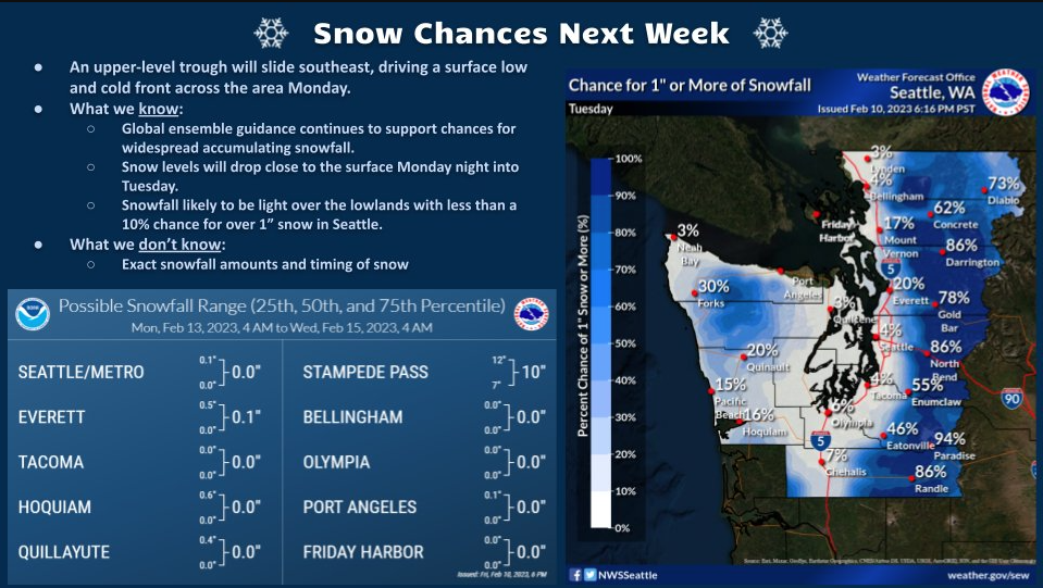
WHATCOM COUNTY, Wash. — Temperatures are expected to drop next week in western Washington lowland areas but whether there will be any precipitation and if the drop will be sufficient to produce frozen precipitation remains to be seen.
National Weather Service (NWS) Seattle office forecasters said this morning, Saturday, February 11th, a cooler and wet weather system is expected to move over western Washington Monday bringing the snow level down to about 1,500 feet. This is expected to bring “significant snow” to the higher elevations and showers to the lowlands. Lowland highs are expected in the mid 40s. Error, group does not exist! Check your syntax! (ID: 11)
Cooling is expected to continue into Monday night with temperatures expected to drop to or below freezing and snow levels dropping to 500 feet or less by Tuesday morning. The chance for precipitation, rain or snow, is also expected to drop. The current NWS forecast is for possible snow showers late Monday and into Tuesday with no significant accumulations expected.
Environment Canada forecasters are predicting cold and clear skies late Monday and into Tuesday. Then a possibility of snow flurries along the southern border of British Columbia late Wednesday and into Thursday.
Whatcom News readers are encouraged to stay up to date with current weather alerts and forecasts and air quality readings for their specific Whatcom County locations along with tide tables via the Whatcom News Weather page.
Discover more from Whatcom News
Subscribe to get the latest posts sent to your email.