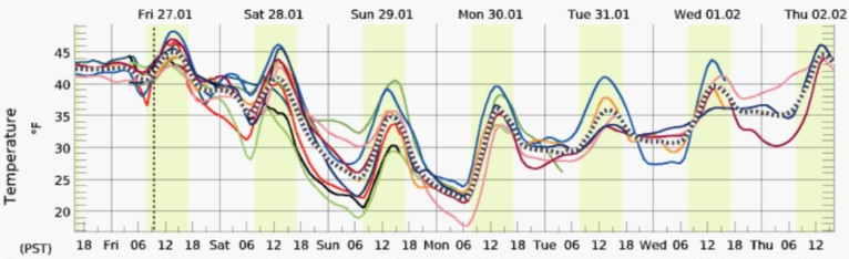
WHATCOM COUNTY, Wash. — National Weather Service forecasters in the Seattle office expect temperatures to drop across several days and a windstorm will start it off.
Error, group does not exist! Check your syntax! (ID: 11)[A] Cool air mass moving into Western Washington behind the trough with Fraser [Valley] outflow winds over the Northwest Interior. Dry and cool Sunday and Monday with upper level ridge offshore. Warming trend by mid week as ridge weakens. National Weather Service (January 27, 2023)
A wind advisory has been issued for 6pm on Saturday to 6am on Sunday due to expected sustained northeast winds of 25 to 35mph with gusts up to 50mph. The advisory area includes western Whatcom and Skagit Counties and San Juan County.
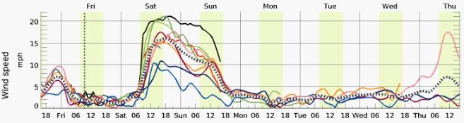
The high winds accompanied by falling temperatures are expected to result in wind chill values below 10° by early Sunday.
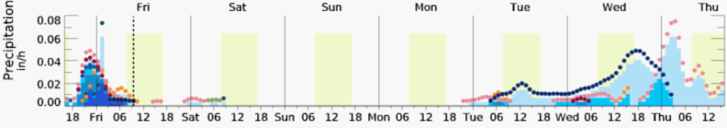
While snow levels are expected to drop below 1,000 feet in areas north of Seattle on Saturday afternoon and to 500 feet or less by Saturday evening, the forecast chance of precipitation in Whatcom County is at or near 0% across all computer weather model forecast ensembles.
Whatcom News readers are encouraged to stay up to date with current weather alerts and forecasts and air quality readings for their specific Whatcom County locations along with tide tables via the Whatcom News Weather page.
Discover more from Whatcom News
Subscribe to get the latest posts sent to your email.