
Click links below to jump to:
- Current alerts
- Detailed forecasts across Whatcom County locations
- Latest air quality reports
- Tides
- Monthly historical temperatures
- Latest weather stories
Alerts
Winter Storm Warning issued April 14 at 9:55PM PDT until April 15 at 11:00PM PDT by NWS Seattle WA
* WHAT...Heavy snow. Total snow accumulations between 8 and 18 inches. Winds gusting as high as 40 mph.
If you must travel, keep an extra flashlight, food, and water in your vehicle in case of an emergency. Prepare for possible power outages.
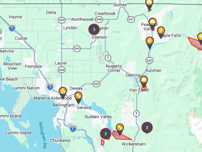
Current detailed forecasts
Click region label to see location-specific current forecast.
Bellingham [Click here to open]
Lummi Island [Click here to open]
Sandy Point [Click here to open]
Birch Bay [Click here to open]
Blaine [Click here to open]
Point Roberts [Click here to open]
Ferndale [Click here to open]
Laurel [Click here to open]
Lynden [Click here to open]
Sumas [Click here to open]
Everson/Nooksack [Click here to open]
Maple Falls [Click here to open]
Glacier [Click here to open]
Deming [Click here to open]
Acme [Click here to open]
Sudden Valley [Click here to open]

Click for more information

Click for more information
Latest air quality reports (monitor locations)
Bellingham [Click here to open]
Columbia Valley/Maple Falls [Click here to open]
Custer/Lynden [Click here to open]

Tides
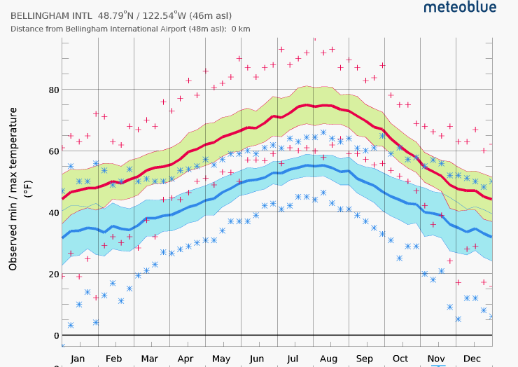
Monthly historical temperatures at Bellingham International Airport
| Month | Avg Max (Red Line) | Avg Min (Blue Line) | 2/3 Range High (Yellow) | 2/3 Range Low (Blue) | Extreme Max (+) | Extreme Min (∗) |
| Jan | 45 | 33 | 52 | 24 | 65 | 4 |
| Feb | 49 | 35 | 55 | 27 | 72 | 5 |
| Mar | 53 | 39 | 60 | 30 | 74 | 12 |
| Apr | 59 | 43 | 66 | 34 | 83 | 22 |
| May | 64 | 48 | 72 | 40 | 86 | 30 |
| Jun | 70 | 53 | 77 | 46 | 92 | 38 |
| Jul | 75 | 56 | 81 | 50 | 96 | 42 |
| Aug | 75 | 56 | 81 | 50 | 98 | 42 |
| Sep | 71 | 50 | 77 | 43 | 88 | 34 |
| Oct | 61 | 44 | 67 | 36 | 78 | 25 |
| Nov | 51 | 37 | 57 | 28 | 69 | 10 |
| Dec | 46 | 33 | 52 | 24 | 66 | 6 |
Latest weather stories
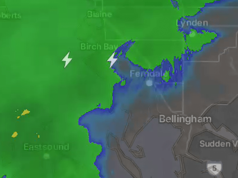
Unexpected thunder rattles NW Whatcom County residents
It was nearly a year ago when a significant lightning storm reached Whatcom County.

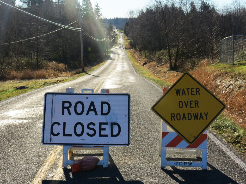
Whatcom roads impacted by streams and river flooding
Slater Road is scheduled to be closed Wednesday.

UPDATED: Heavy rains and melting snowpack bring flood watch alert
NWS advises “… monitor later forecasts and be alert …”
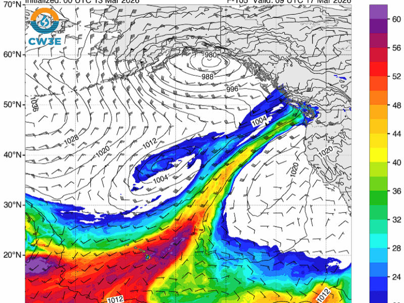
Heavy rains forecast to raise the Nooksack River level next week
“… rivers over the northern portion of the area bearing watching through the first part of the week.”
Whatcom County reportedly dodged the worst of windstorm
As of 8am, over 30,000 remained without power across the Puget Sound region.
Something went wrong. Please refresh the page and/or try again.
Share this page with friends and family