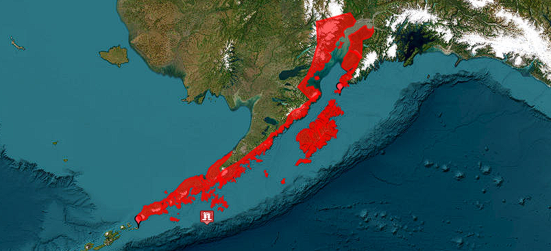
WHATCOM COUNTY, Wash. — A magnitude 7.3 earthquake was detected about 1:40pm (Pacific Time) on Wednesday, July 16, 2025, in the area 55 mile south of Sand Point, Alaska.
An initial report at 1:42pm from the National Weather Service (NWS) National Tsunami Warning Center in Palmer, Alaska, said a tsunami warning was issued for the southern Alaskan coast and the Alaska Peninsula. The level of danger for other US and Canadian Pacific coasts were still being evaluated.
A second report at 2:13pm a tsunami wave had been confirmed but there was no threat to other US and Canadian Pacific coasts outside of Alaska.
The earthquake was reported to have a depth of 12 miles.
FORECASTS OF TSUNAMI ACTIVITY
-----------------------------
 * Tsunami activity is forecasted to start at the following
   locations at the specified times.

                 FORECAST
                 START
SITE             OF TSUNAMI
----             ----------

 * Alaska
Sand Point       1330 AKDT Jul 16
Cold Bay         1425 AKDT Jul 16
Kodiak           1440 AKDT Jul 16
– National Weather Service (NWS) National Tsunami Warning Center in Palmer, Alaska
Discover more from Whatcom News
Subscribe to get the latest posts sent to your email.