WHATCOM COUNTY, Wash. — While the timing varied across the county, Whatcom County has, at least for now, warmed up significantly last night, well above freezing in the lowlands, for the first time since December 24th. These changes coincided with winds shifting from northeasterly to southeasterly.
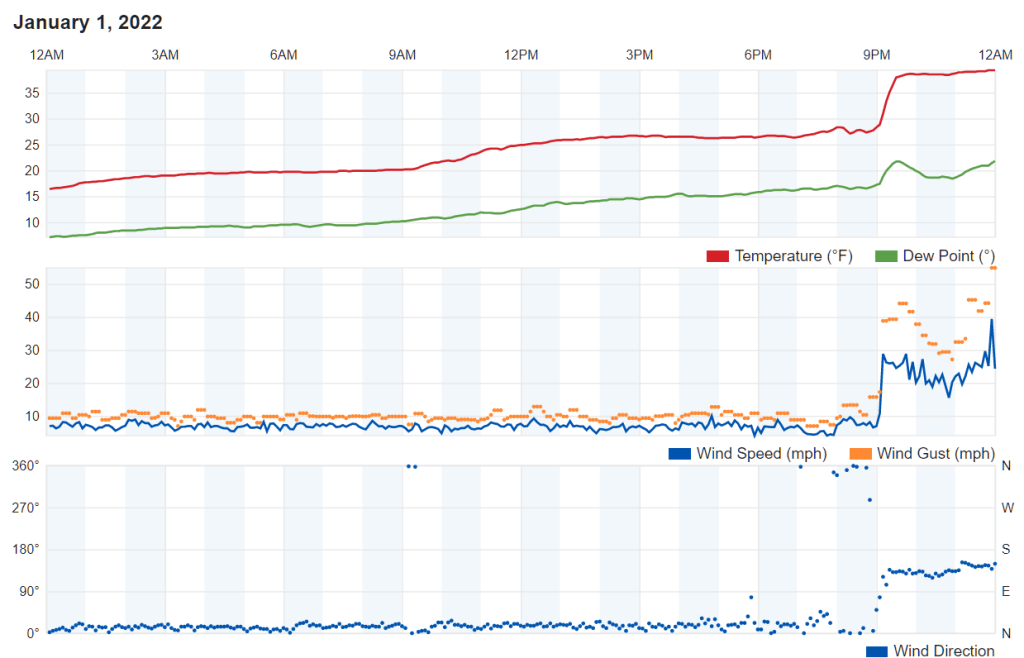
According to a weather station in Ferndale, gusts of 55mph were recorded about midnight and about 1:15am. The weather station reported a temperature increase of 10 degrees in about 30 minutes as the temperature rose from the upper 20s to the upper 30s between 9pm and 9:30pm.
The Bellingham International Airport reported a 53mph gust about 11:50pm with the temperature increases beginning about 6pm, with a slower increase in temperature over hours following.
Snow accumulations were visibly reduced by this morning leaving well-traveled roads mostly bare and wet.

Click for more information

Click for more information
As of 9am today, a National Weather Service high wind warning remains in effect for Whatcom County until 4am Monday, January 3rd. The latest update warns of sustained southeast winds of 35 to 45mph with gusts up to 55mph.
Puget Sound Energy reported about 100 of their customer addresses were without power in Whatcom County this morning due to a handful of scattered localized outages. The cause cited for most of the outages is fallen trees/vegetation and about half were reported as having begun between 1am and 2am.
Temperatures in the lowlands are forecast to remain above freezing until at least Monday night. Chance of precipitation increases later today and is expected to continue as rain and/or snow periodically through the week.
Whatcom News readers are encouraged to stay up to date with current weather alerts and forecasts and air quality readings for their specific Whatcom County locations along with tide tables via the Whatcom News Weather page.
Discover more from Whatcom News
Subscribe to get the latest posts sent to your email.
If you want to see highest wind speeds, checkout the WeatherUnderground sites on Sandy Point…76.2 mph is the highest I’ve seen in the past week…