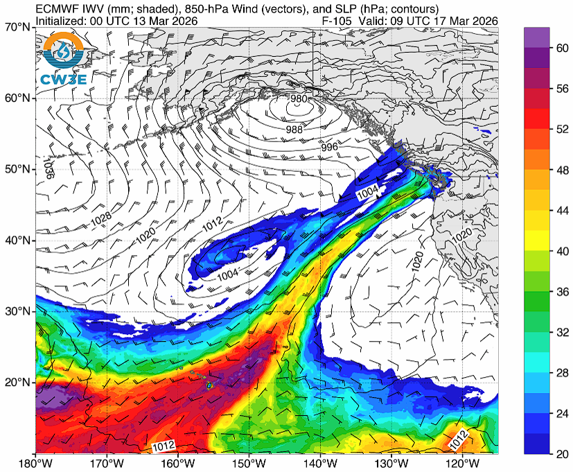
WHATCOM COUNTY, Wash. — Forecasters with the National Weather Service Seattle office are watching an atmospheric river forecast to arrive in western Washington next week bringing winds and heavy rains to the lowland and mountain regions, including Whatcom County.
The threat for flooding will briefly ease on Sunday before an atmospheric river is expected to move inland to the north early next week. This could bring additional flooding concerns to portions of the area- with rivers over the northern portion of the area bearing watching through the first part of the week.
– National Weather Service Seattle office (March 13, 2026)
The following details the currently expected 24-hour rainfall amounts during next week.

Click for more information

Click for more information
| Location | Mon. | Tues. | Wed. | Thur. |
|---|---|---|---|---|
| Bellingham | 0.92″ | 0.88″ | 0.99″ | 1.69″ |
| Lummi Island | 0.70″ | 0.62″ | 0.53″ | 0.57″ |
| Sandy Point | 0.30″ | 0.25″ | 0.11″ | 0.13″ |
| Birch Bay | 1.25″ | 1.14″ | 0.88″ | 1.47″ |
| Blaine | 1.37″ | 1.18″ | 0.88″ | 1.50″ |
| Pt Roberts | 1.19″ | 0.52″ | 0.67″ | 1.69″ |
| Ferndale | 1.11″ | 1.09″ | 1.73″ | 1.69″ |
| Laurel | 1.10″ | 1.23″ | 1.93″ | 1.69″ |
| Lynden | 1.16″ | 1.30″ | 2.00″ | 1.69″ |
| Sumas | 1.09″ | 1.32″ | 1.53″ | 1.69″ |
| Everson/Nooksack | 1.10″ | 1.20″ | 2.10″ | 1.69″ |
| Maple Falls | 1.04″ | 1.37″ | 1.62″ | 1.69″ |
| Glacier | 1.11″ | 1.51″ | 1.72″ | 1.89″ |
| Deming | 0.99″ | 0.94″ | 1.17″ | 1.69″ |
| Acme | 1.00″ | 0.91″ | 1.09″ | 1.69″ |
| Sudden Valley | 0.91″ | 0.84″ | 0.95″ | 0.83″ |
The current Nooksack River level forecast currently expect the river to crest at levels below flood stages.
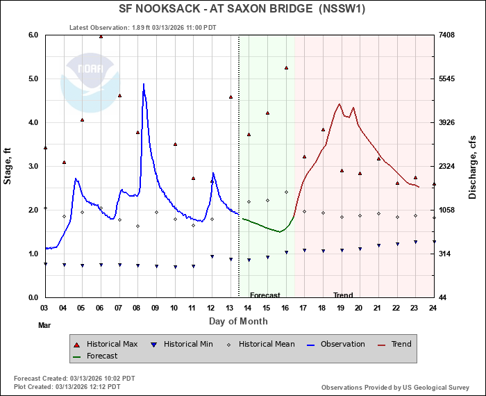
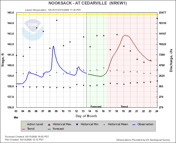
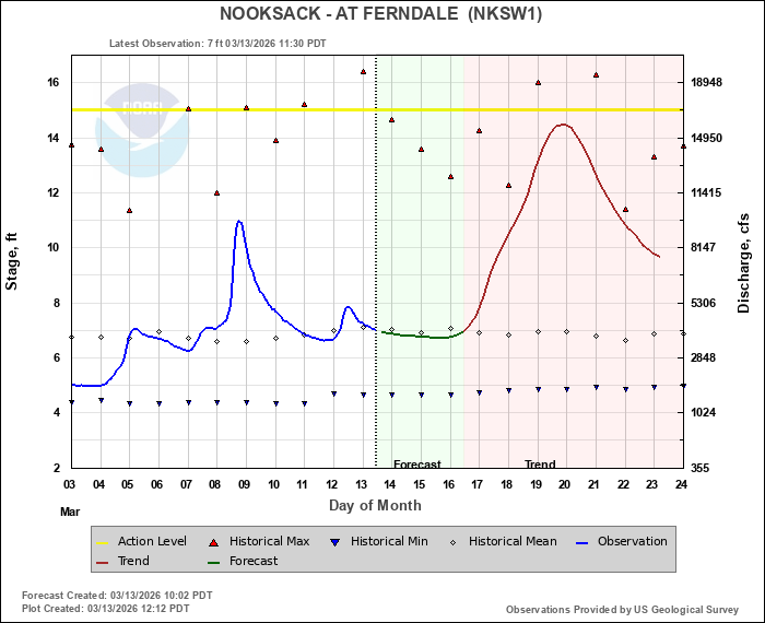
River level forecasts can change frequently so motorists and property owners are advised to monitor the Nooksack River level forecast.
Whatcom News readers are encouraged to stay up to date with current weather alerts and forecasts and air quality readings for their specific Whatcom County locations along with tide tables via the Whatcom News Weather page.
Discover more from Whatcom News
Subscribe to get the latest posts sent to your email.