WHATCOM COUNTY, Wash. — Pacific Northwest weather is currently being impacted by a strong El Nino climate pattern and has seen record warm temperatures over the past month. Forecasters are wondering if that may be about to change.
Weather forecaster Cliff Mass said yesterday, January 2nd, “a very favorable pattern for mountain snow” was expected to develop Saturday with a similar and stronger system expected Tuesday. He added that due to expected cooling, “some snowflakes may even reach sea level over western Washington.”
Forecasters with the National Weather Service Seattle office said today that low temperatures Sunday and Monday mornings are expected to be near freezing but, given the expected lack of precipitation during these times, “the potential for any wintery mix in the lowlands seems minimal at this time.”
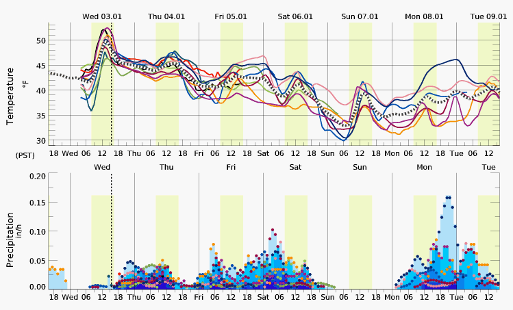
Confidence in weather forecasts beyond 5 days is typically considered low.
Whatcom News readers are encouraged to stay up to date with current weather alerts and forecasts and air quality readings for their specific Whatcom County locations along with tide tables via the Whatcom News Weather page.
Discover more from Whatcom News
Subscribe to get the latest posts sent to your email.