While the trend appears for areas south of Whatcom County to continue to receive heavier snowfall, western Whatcom County should still be prepared for the possibility of snowfall through next weekend.
Another weather system, weaker than Friday’s, is expected to arrive later this afternoon today, Sunday, February 10th, bringing with it an increased chance of precipitation. Subfreezing temperatures, when combined with precipitation, are likely to turn that precipitation to snowfall.
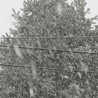
National Weather Service (NWS) Seattle office forecasters updated their forecasts with an increased chance of precipitation for the Ferndale area this afternoon and tonight of 60%, saying to expect snow accumulations of less than one inch this afternoon and up to an inch overnight.
Today’s temperatures are expected to range between a high in the upper 20s and a low in the low-20s or upper-teens. Blustery winds are expected to return with wind gusts up to 20mph today and 30mph tonight, nowhere near the strength of yesterday’s 50mph+ gusts.

Click for more information
Click for more information
A Winter Weather Watch has been issued for the northwest and west central Washington regions, including western Whatcom County, for 4pm today through 4am tomorrow. It advises to expect 1 to 4-inch accumulations this afternoon and tonight across these regions.
A Winter Storm Watch has been issued for 10am Monday through 6pm Tuesday for the same regions warning of 5 to 8-inch accumulations Monday afternoon through Tuesday afternoon.
Ferndale area temperatures are expected to remain cold enough to support the potential for snow until Wednesday when daytime high temperatures could begin reaching the mid- to upper-30s.
Looking specifically at the Ferndale area, here are the current snow forecasts for the days ahead according to NWS forecasters.
| Precipitation % (Day/Nite) | Estimated Accumulations (Day/Nite) | |
| Monday | 30% / 70% | <.5″ / 1-2″ |
| Tuesday | 60% / 40% | 1-2″ / <.5″ |
| Wednesday | 10% / 10% | 0″ / 0″ |
| Thursday | 30% / 30% | <.25″ / <.25″ |
| Friday | 50% / 50% | rain or snow? |
NWS forecasters warn that during the winter weather advisory periods there will be the potential for significant snow, sleet or ice accumulations that may impact travel.
Discover more from Whatcom News
Subscribe to get the latest posts sent to your email.
