WHATCOM COUNTY, Wash. — Moderate to heavy rain and snow levels rising to 8,000-9,000 feet by this afternoon have residents in portions of the northwest and western Washington paying close attention to river level forecasts.
Heavy rain along with rising snow levels Monday into Tuesday will lead to rapidly rising rivers across the area. It is likely that many rivers will reach flood stage late Monday night or Tuesday. National Weather Service (November 4, 2023)
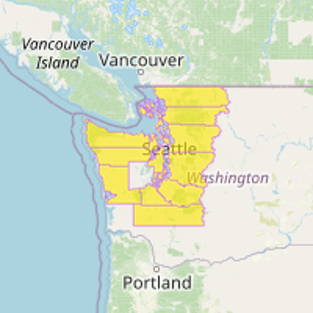
Flood watches have been issued for nearly all counties around the Puget Sound area, including Whatcom County, as displayed in the graphic below.
Excessive rainfall Monday and Tuesday with 7 to 10 inches possible over the Olympics, 5 to 9 inches over the Cascades, 3 to 5 inches along the coast and 1.5 to 3 inches over the interior lowlands. Snow levels will rise to around 9000 feet Monday night before dropping Tuesday.
Advertisement
Click for more informationNational Weather Service flood watch statement (November 4, 2023)Advertisement
Click for more information


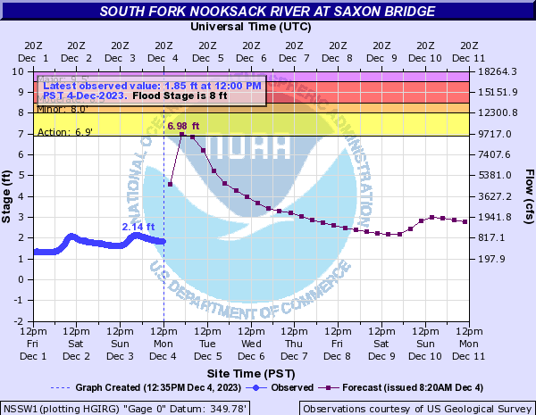
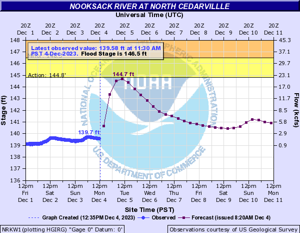
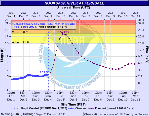
As of 8:30am on Monday, December 4th, the river level at gauge locations on the Nooksack River is forecast to crest below the action stage range except for the Ferndale gauge where it is forecast to crest just below minor flood stage.
A potent atmospheric river is beginning to affect the region, with heavy precipitation and widespread river flooding. Gusty winds are also expected today – peaking this afternoon and evening – windiest along the coast and areas from Whidbey Island northward. National Weather Service western Washington forecast discussion (December 4, 2023)

Looking at the extended forecast, some reduction in the chance of precipitation appears to arrive Friday but a brief round of moderate to heavy rain appears on track for Saturday although the forecast confidence for that timeframe is currently low.
River level forecasts can change frequently so motorists and property owners are advised to monitor the Nooksack River level forecast.
Discover more from Whatcom News
Subscribe to get the latest posts sent to your email.